
Ladakh, ‘the land of the high passes,’ with its haunting, surreal mountain beauty, sits splendidly on India’s forehead, bordering Tibet, Pakistan, and China. Previously, it was a key intersection for trade with Tibet, but as China's government began to seal its borders in the 1960s, global trade declined. Nevertheless, it is still strategically important owing to its delicate location, and the area has a large presence of Indian military troops.
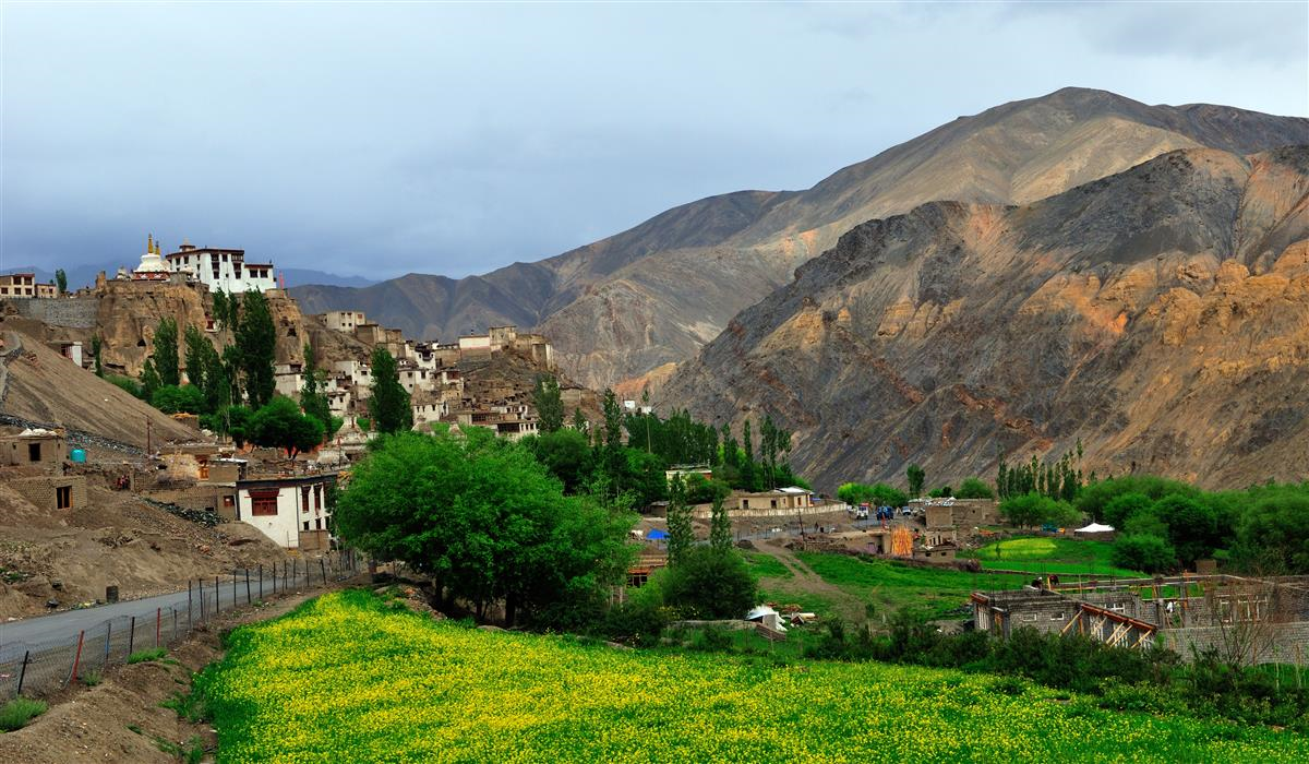
The rugged terrain with tall, snow-peaked barren mountains fringing cobalt lakes and deep gorges continues to enthral travellers the world over. Monasteries and stupas twinkle like charmed trinkets in large spaces of serene emptiness, and icy winds carry stories of a time past. The desolate draw of the jagged land is evocative of an ancient culture with its unique customs and traditions. Often referred to as ‘Little Tibet’ due to its centuries-strong association with Tibet, Ladakh consists of two districts – Leh and Kargil. The former typically captures all the spotlight as it falls on the tourist circuit, with the Leh district housing the erstwhile sole capital city of Leh as well. Post-October 2019, Kargil and Leh will be joint capitals of the Union Territory of Ladakh.
History: Known by different names in the past, Ladakh’s first known settlers were the Mons and Dards from the Himachal Pradesh and Gilgit regions. They were overpowered by the Mongols from Tibet, and for several centuries afterward, Ladakh was the focus of intense tussles between the Tibetan and Chinese empires, with added incursions from Islamic invaders. Eventually, the Tibetans were successful in quelling Chinese invasions, and numerous reigns descending from the kings of Tibet ruled Ladakh as an independent kingdom for nearly 900 years. Under Sengge Namgyal, who is famous for constructing the Leh Palace and the Hemis monastery, this empire reached its pinnacle of glory in the seventeenth century. His rule extended to western Tibet and beyond Mount Kailash and Mansarover Lake.
Due to its political stability, Ladakh galloped to the prime position of being recognized as the finest trade route between India and Central Asia. Loaded caravans of textiles, spices, raw silk, and carpets were traded, generating immense revenue for the state. Leh was a mid-point on the long export route, and it developed into a lively storehouse of goods with bazaars packed with traders from remote countries. Fatefully, the profitable industry that helped the realm thrive and expand ultimately led to its downfall by catching the attention of the Dogra kings, who attacked and plundered the kingdom in the 19th century. The aftermath was several years of turmoil, which concluded with British dominance in India. Eventually, Ladakh was incorporated into the Union of the newly independent nation of India in 1947.
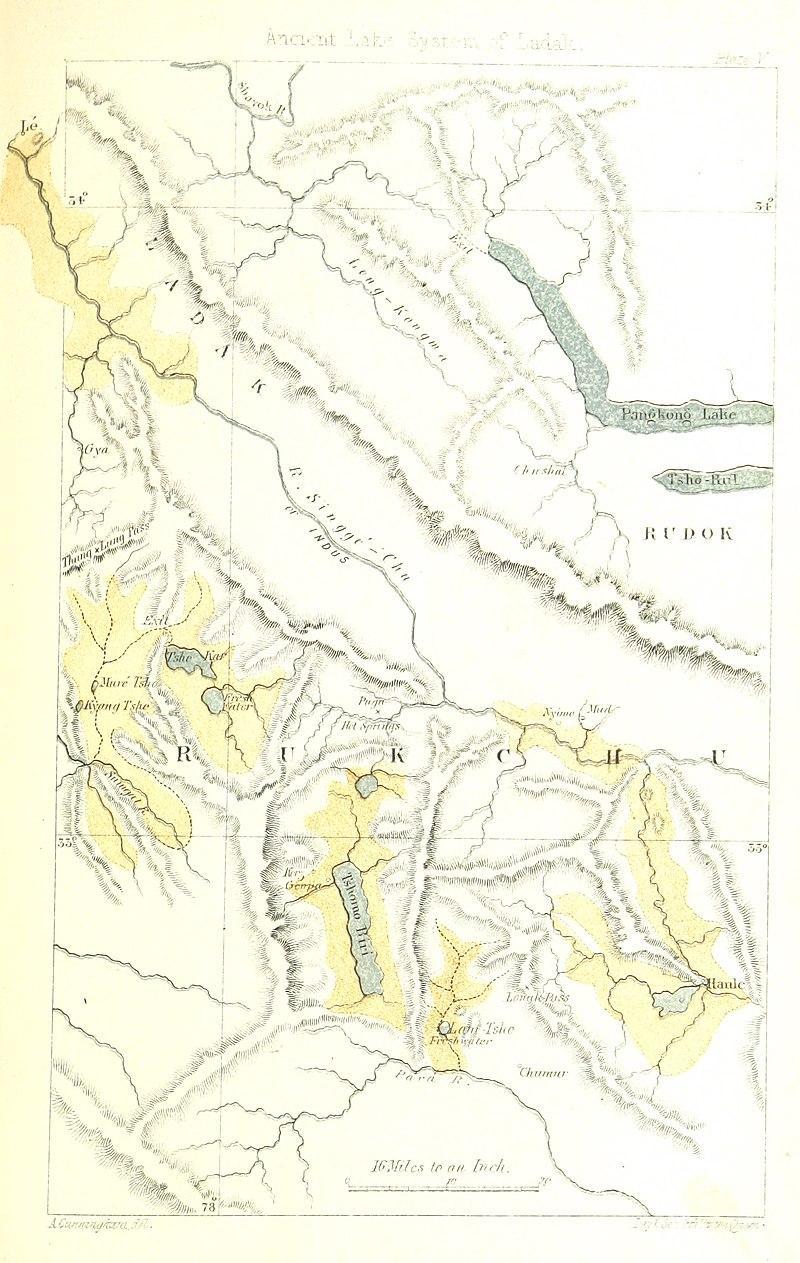
An old map of Ladakh by British Army Engineer Alexander Cunningham
Kargil District – The Icy Ground with Unmapped Perfection
Kargil remains an unexplored mystery for many and today commonly evokes memories as a center of the Indo-Pakistan conflict, or the Kargil War, in 1999. Known as Purig in earlier times, Kargil was unified by Gasho Tha Tha Khan, who brought small, warring princely states under his rule. A large majority of the people in the area practice Islam due to the advent of religious preachers in the 15th century. The seamless fusion of Tibetan and Islamic-Iranian influences can be seen in the architectural styles of monuments.
Kargil is also a goldmine of uncharted ethereal beauty where plentiful snow and the high mountains do a merry dance, birthing glistening rivers, cavernous valleys, and icy glaciers with the crisp air cutting through sharply. Suru, Drass, and Zanskar river valleys comprise this district, sprinkling gold dust on Kargil’s natural bounty.
Apricot Bloom: Few are aware that Kargil is bursting with color in April with apricot blossoms. A mountain setting of deep brown contrasting with a cerulean sky and pink and white bunches of flowers on apricot trees presents a kaleidoscopic vision. The flowers transform into yellow and orange tart fruit to be harvested and sold. The Apricot Blossom Festival, or Chuli Mendok, is promoted by different departments in Ladakh and is celebrated in various villages, most notably in Darchik. It is an integral cultural meeting celebrating Ladakh’s landscapes and heritage, signifying the onset of summer after a long and harsh winter. Local artists contribute to the festival with musical performances, attracting tourists, and it is a time of great revelry for the residents. Produce is sold, boosting the local economy.
Apricot, or chuli, is not indigenous to Ladakh and was introduced to the arid land more than a century ago by Chinese traders passing through the Silk Route. The superior Halman variety of apricot dominates the Kargil district, and almost every household in Ladakh has planted apricot trees in their yard. Apricots are sun-dried or turned into jam, and locals have been enterprising by not only selling their yield but also by introducing homestays centered around apricot villages for tourists.
https://www.instagram.com/reel/CrbKi0Istfw/?utm_source=ig_web_copy_link&igshid=MzRlODBiNWFlZA==
Suru Valley: Virtually unknown and untouched, the Suru Valley is an emerald jewel in the Ladakh area, fed by the ice-melted Suru River, a tributary of the mighty Indus River. Comfortably nestled at just below 10,000 feet, it separates Kargil from the Zanskar Valley and extends up to the Pensi La Pass, a mountain pass connecting Suru Valley to the Zanskar Valley region. One of Ladakh’s best-kept secrets, the luxuriantly green valley is conspicuous in the unicolor cold desert scenery, protruding like an oasis. Willow and poplar trees line the road leading to the valley with sprays of wild roses and peony bushes.
One can divide the valley into two disparate sections, The Lower Suru Valley is one of the most fertile regions of Ladakh due to the Suru River feeding the soil. The Dard and Tibetan residents here grow barley and an assortment of vegetables in their gardens. In contrast, the upper reaches of Suru Valley are rugged, with ice-capped mountains, gigantic glaciers, and glossy lakes. The starkness of the verdure is a picturesque sight. The valley is home to nature’s grand marvels, including the Nun Kun mountains, the Drang-Drung, and Pensi La glaciers, among others. Suru Valley has captured people’s interest in the past two years, and at Offbeat Tracks, we can curate these experience-rich expeditions to uncharted territories.
https://www.instagram.com/p/CuEiuFSpGvZ/?utm_source=ig_web_copy_link&igshid=MzRlODBiNWFlZA==
Nun Kun: The twin peaks sit regally on a forbidding Himalayan mountain range, where Nun is located on the border of Jammu and Kashmir, and Kun falls in Kargil. The glittering crests are separated by a white highland, and the mountain massif is fenced by the spectacular Suru and Zanskar valleys. Reachable by the Kargil-Zanskar road, the meandering drive to the peaks is stunning, with the rocky mountains set against an azure sky gleaming brilliantly along the road.
Organized treks to these impressive summits are routinely conducted. The first person to ascend the 23,000 feet high Kun Peak was Mario Piacenza, an Italian mountaineer, in 1913. After that, the Indian Army Expedition only managed to successfully summit in 1971. The trail poses technical challenges demanding expert knowledge and skill in mountaineering, roping, and the use of ice axes, along with physical endurance and fitness. Nevertheless, the awe-inspiring snowy trail with mountain ranges piercing the blue skies is a thrill most trekkers seek. For Kun, one travels from Kargil to Shafat village, a slow 5-hour drive, up the Suru valley with the Suru River for gurgling company. The expedition takes three weeks starting from Shafat, and the hike to the prime base camp traverses through open meadows and glacier debris. After a day’s stop, the climb to Kun is fragmented over several days of stops at other camps with an arduous crossing of high plateaus, glacial formations, frosty slopes, cratered surfaces, sharp cliffs, and unpredictable weather. The grueling climb, however, concludes with a spellbinding view from the peaks of satellite summits such as The Pinnacle, Barmal, and White Needle Peak, forming a trademark horseshoe above the Suru River. One can even witness the astonishing view of the snowy elegance of the enormous Drang-Drung Glacier, a winding river of ice atop Pensi La Pass above 15,000 feet, encircled by the giant Himalayan mountains. At a length of 23 kilometers, the glacier is among the largest glaciers in Ladakh, second only to the Siachen Glacier in the Karakoram Range. The rugged landscape, opulent green valley, winding rivers, and smaller snow-clad mountain peaks seem to intersect in a fittingly designed painting.
https://www.instagram.com/reel/CmdlzcUOZW0/?utm_source=ig_web_copy_link&igshid=MzRlODBiNWFlZA==
Rangdum Monastery: A Tibetan monastery of the Gelugpa, or yellow-hat order of Buddhism, the 200-year-old Rangdum Monastery sits on a steep hill at 12,000 feet, in one of the most isolated areas of Suru Valley, twenty-five kilometers away from Pensi La Pass. Inscriptions in the sanctum hint that the fortified shrine was built by Gelek Yashy Takpa during the reign of King Tsewang Mangyul of Ladakh, in the 18th century.
The raw beauty of the valley that surrounds the gompa, as well as the jagged alpine mountains, gleaming glaciers, and the entire panorama of the gompa, gradually come into view.
The monastery is renowned for its ‘Mani’ stone walls. ‘Mani’ stones are originally stone plates or rocks engraved with the six-word mantra of Om Mani Padme Hum, which is roughly translated to ‘the jewel in the lotus of the heart,’ as a form of prayer to Lord Buddha. Today, other devotional signs and symbols are also carved out on these stones, and they are placed along roads and rivers, grouped to form the shape of a stupa, or placed on long walls, as an offering to the spirits of a place. The stones are painted in colors symbolic of each word (om - white, ma - green, ni - yellow, pad - light blue, me - red, and hum - dark blue). Buddhist practices decree that these walls should be passed from the left side in a clockwise direction according to the rotation of the earth. The ‘Mani’ walls in the Rangdum gompa are unique because, apart from the usual inscriptions, some stones have pictures of chortens, or Buddhist temples, and mandalas, Buddhist devotional images.
The monastery houses a museum featuring a wide collection of Tibetan and other artefacts from the region. The central prayer hall is also a pictorial highlight with a vast collection of Tibetan art objects and statues. The shrine is home to forty monks who survive on the largesse of the food supply sent by the villagers of Julidok village. Owing to the deplorable conditions of the road leading to the monastery and its remote location, Rangdum has managed to preserve its pristine beauty.
https://www.instagram.com/reel/CuAD5r1MXr1/?utm_source=ig_web_copy_link&igshid=MzRlODBiNWFlZA==
The distance between Kargil and Leh is around 215 kilometers, with the Leh-Kargil highway in excellent condition. Travelers can hire cars to traverse the distance in 6 to 8 hours. There are several scenic spots along the route, covering two major mountain passes - Namika La and Fotu La. The lesser-known route is via Batalik, which takes 9 to 10 hours with narrow roads, skipping the mountain passes, and zigzagging across the Aryan Valley.
Leh, The Land of the Lamas
Glorious picturesque landscapes with the rugged beauty of the Himalayas, shining lakes, charming monasteries, and colourful festivals, unravelling at a lazy pace, position Leh as a vibrant nucleus for travellers seeking both adventure and aesthetics. Its three diverse regions—Sham Valley, running along the icy-blue Indus and its tributaries, Nubra Valley, adorned with a rugged landscape, and Changthang Valley, often labelled as the roof of the world—each occupy their own special corner, complementing each other.
Changthang:
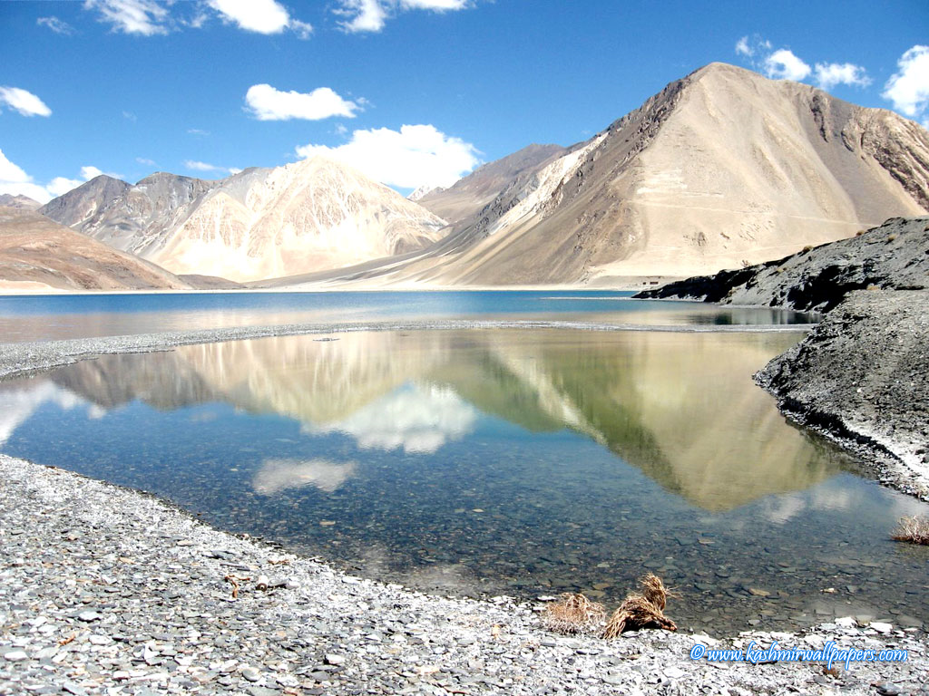
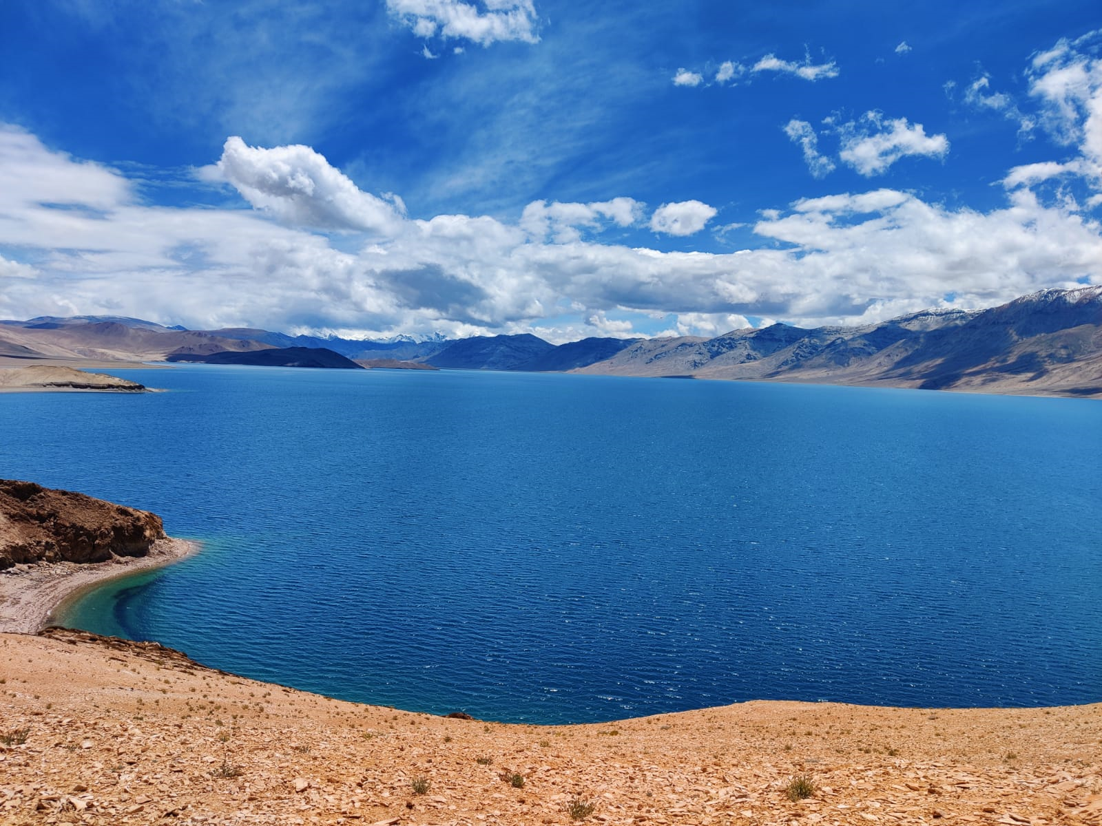
Tso Moriri: The ‘Mountain Lake’ or Tso Moriri, located in the Changthang Plateau in the Leh district, at an elevation of 15,000 feet is the largest high-altitude lake in India. Dressed in varying hues of blue, the dazzling lake shimmers with the reflection of the changing images of the clouds above it. Stately mountains in graded shades play a stellar supporting role with the highest peaks covered in white, softly shifting to light brown, and finally a deep, dark coffee tone. Witnessing the changing pigments of Tso Moriri under a sunny sky with the wind howling in one’s ears is a soul-stirring experience.
Also known as the Tso Moriri Wetland Conservation Reserve, it is the highest Ramsar site in the world, nominated to be of international importance. The lake is renowned for birdwatching with an astounding assemblage of migratory birds, especially from Siberia, of varying sizes. The lake freezes during the harsh winter months and it is a common sight to see villagers and their cattle walk freely on its frozen surface. Tso Moriri is revered by the local community and has been sworn as a 'Sacred Gift for a Living Planet' by the inhabitants with efforts from WWF India.
The closest airport to the lake is Leh and one can hire a taxi for a 6-hour journey to get here.
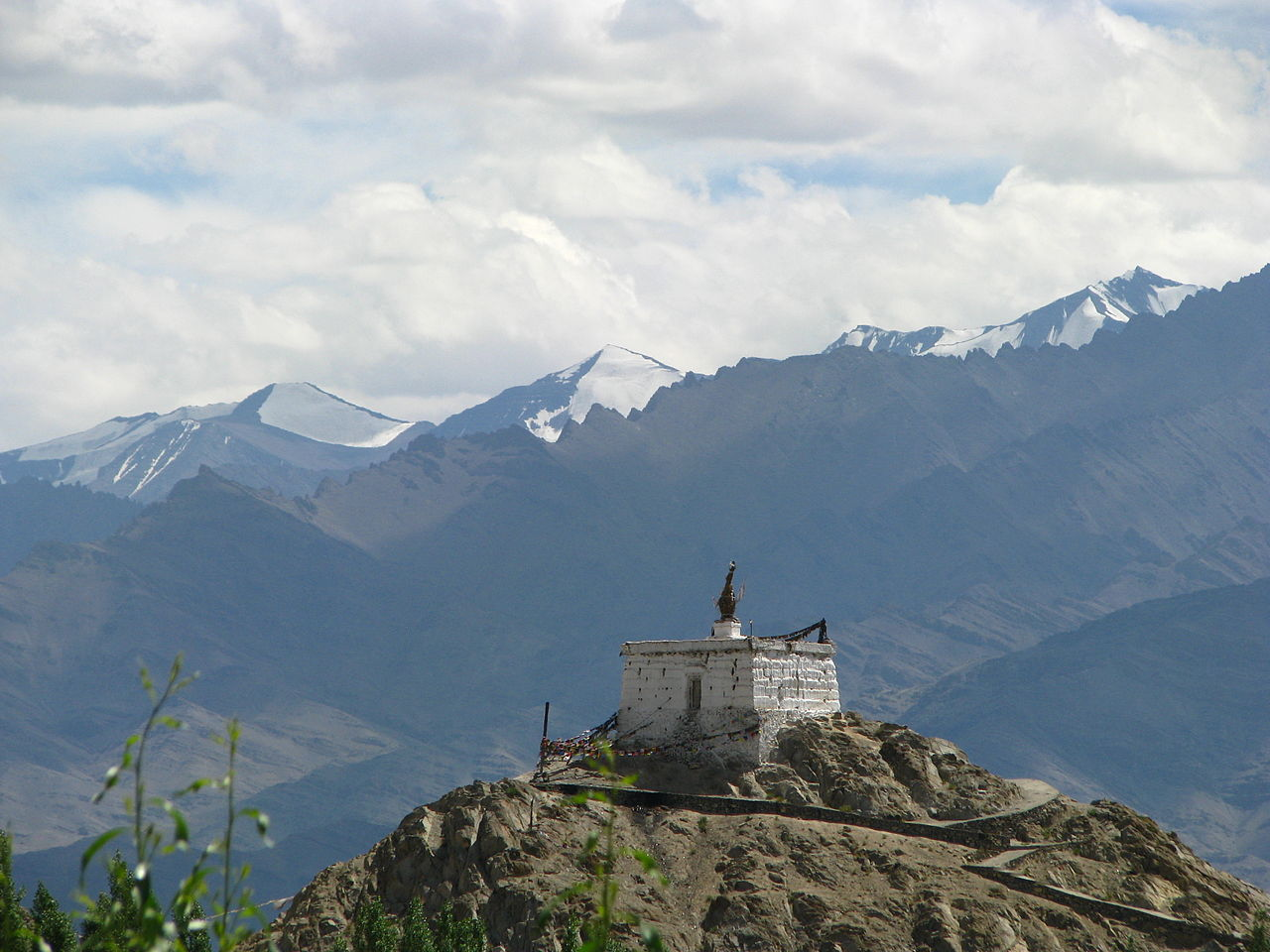
Korzok Monastery: Located at 15,000 feet in Korzok village and overlooking the Tso Moriri Lake sits a 300-year-old Tibetan monastery from the Drukpa lineage. The independent monastery was founded by Kunga Lodro Ningpo, the third Korzok Rinpoche, a spiritual leader. Its history can be traced back to ancient nomadic kings ruling the hostile territory, fighting several losing wars, and leading a life of seclusion. Seeking help from Tibet, they managed to win the battles and eventually one of the Tibetan lamas established the monastery at Korzok, fostering a change in the locals to adopt Buddhism in favour of animism.
Unlike other monasteries perched on hilltops, the Korzok gompa is built on a gentle gradient and houses the statue of Shakyamuni Buddha, the founder of Buddhist teachings, with images of other deities and intricate Thangkas, a Tibetan Buddhist painting on cotton or silk depicting a Buddhist idol or symbol. Smaller chortens or shrines dot the passage leading to the monastery, and a striking photong, or official residence of the chief lama, is also located near the temple.
Korzok attracts a sea of travellers during the Korzok Gustor festival, which is held in July or early August, over two days, at the monastery. The festival commences with a symphony of sounds from dung-chen, long trumpets, bells, and cymbals. Masked or cham dances by lamas in colourful costumes dominate the celebration. The festivities culminate with an interesting ritual called Argham or killing and dismemberment of the Storm, a sacrificial cake, symbolising the destruction of evil.
https://www.instagram.com/p/CpF3CEHPc9L/?utm_source=ig_web_copy_link&igshid=MzRlODBiNWFlZA==
Nubra Valley: A geographically blessed region, the Nubra Valley or ‘Valley of Flowers’ is sited at an altitude of 10,000 feet, sandwiched between the Karakoram and Ladakh mountain ranges of the Himalayas. Alexander Cunningham, a British Army engineer titled Nubra as one of the five natural partitions of Ladakh. Fenced in by snowclad mountains below the cotton candy clouds, the valley mirrors the moon in winter and is thick with foliage in the summer months with orchards bursting with apples and apricots. Home to panoramic scenery, cold deserts, iridescent lakes, historical monasteries, and a plethora of wildlife, the Nubra region pulsates with effortless charm.
https://www.instagram.com/p/CkMLB8oSRF7/?utm_source=ig_web_copy_link&igshid=MzRlODBiNWFlZA==
Historically, the valley was on the Silk Route map for trade between Tibet and Turkistan. Conquered by several invaders such as the Mongols, Chinese, and Arabs in the 7th century, it was eventually dominated by Buddhists. Several monasteries, with their cleansing chants, seemingly purify the air. The oldest and largest monastery in the Leh district, the Diksit Monastery, established in the 14th century, is located here.
The confluence and twisting waterways of the Shyok and Nubra rivers, make the valley a lush provider of flora and fauna, and it is significantly known for its forests of the Hippophae shrub or Leh Berry Seabuckthorn . The sound of chirping birds such as the white-browed tit-warbler, mallard, and common sandpiper is redolent of the flourishing fauna in the region. Exclusive wildlife in the region can also be spotted in the high-altitude cold desert in Hunder Village. Taking a ride on the double-humped Bactrian camels, native to Hunder, softly making their way among the rolling white dunes and poplar trees, against bare mountains with the crimson dye of the sun and the murmur of the Shyok river, is a wonder to behold. In ancient times, when Ladakh was a significant halt on trading routes, the Bactrian camels were the main mode of transport through the Khardung La Pass, which connects Leh to Central Asia back in the day. But now the pass serves as the main connection of Leh to the Nubra Valley and Turtuk. Today, it is a nerve center for the Indian Army and is used to carry important resources to the Siachen Glacier. Winding roads keep glaciated peaks, remote monasteries, and tiny hamlets such as Kharjung and Khalsar, perfect company as one drives through one of the highest navigable passes in the world, duly called the opening to the Nubra Valley.
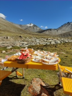
A picnic lunch at the high altitude meadows just after Wari La pass
The other alternative to Nubra Valley today is the sublimely beautiful Wari-La Pass, through the Indus Valley, which opened in 2008. Albeit not as well paved as the road to Khardung La Pass, it is pegged as the 4th highest pass in the world, with minimal tourists choking the roads and wild horses, goats, and sheep grazing against a clear blue sky and fresh streams.
Not that touristy, the pass descends into high altitude pastures with grazing yaks and marmots as far as the eye can see.
Leh and Kargil: A Comparison
- Accessibility: Leh is reachable by multiple modes of transport, and has an airport with direct flights from Chandigarh, Delhi, Jammu, Mumbai, and Srinagar. Kargil is mainly accessible from Srinagar in Kashmir, with taxis available from the Srinagar airport, 200 kilometres away. Most roads in both districts remain largely closed in winter.
- Countryside: The landscapes of both districts are beautifully varied with deep valleys, high passes, mighty mountains, and large lakes. However, larger sections of Kargil are undiscovered and therefore remain pristine compared to Leh.
- Accommodation: Leh provides more lodging options for tourists with a basic hotel charging INR 4000 per night. Kargil has fewer choices but is cheaper with a standard rate of INR 2500 per night.
- Culture: Similar and overlapping customs exist in both districts, but Kargil’s cultural diversity is greater as it expands to include both Buddhists and a large Shia Muslim community, resulting in varied dialects. Leh is predominantly Buddhist.
- Cuisine: Kargil is a land of spicy, heavy curries, meatballs, and kebabs due to the Islamic influence. Leh has lighter food with Mokmok, or steamed dumplings, and Thupka, a noodle soup with boiled vegetables and meat, taking centre stage.
Ladakh has always been a utopian paradise with a repository of spectacular sights and scenery. At Offbeat Tracks we are committed to not only offering the best in terms of Ladakh’s aesthetics and experiences to our guests, but we also believe in contributing to and uplifting rural communities. In 2017, we collaborated with the Ladakh Environment and Health Organisation for a solar electrification project in the tiny hamlet of Takmachik village. The successful project powered inaccessible houses with solar lights which remained in perfect working condition for over five years.
Visits to historic settlements leave large hints of the traditions of ancient periods still observed today. Whether it is a short sojourn to Leh or Kargil, the overwhelming resplendence of nature promises a trip filled with memories of a lifetime. Call Offbeat Tracks to prepare a schedule for you befitting the magnificence of Leh and Ladakh. Learn about their organic methods of farming and livelihood and help us add to their earnings, boosting the economy of mountain communities.
.png?height=500&name=World%20Entrepreneurship%20Day%20(1).png)
'_(11042863396).jpg)
.jpg)